Ogema, Wisconsin
Home of Timm’s Hill — Wisconsin’s Highest Point
Ogema: Then and Now
A morphing comparison of historic and present-day Ogema, Wisconsin.
1,951.5 ft (Timm’s Hill)
Swedish & Ojibwe
~713 (2024 est.)
Open year-round
Small-Town Charm, Big-Time Views
Ogema, WI sits in the hill country of southern Price County, where the glaciers left behind ridges, lakes, and the highest natural point in Wisconsin. It’s the kind of place where you can hike to a 30-mile panoramic view in the morning and be the only person on the trail. If you’re looking for information about Ogema, Wisconsin — whether for the hiking, the history, or just a quiet weekend — here’s what you need to know.
Origin of the Name
Derived from the Ojibwe word meaning “Chief” or “Leader,” Ogema lives up to its name as the geographic leader of the state — home to Wisconsin’s highest natural point at 1,951.5 feet.
Ogema Landmarks
🏔️ Timm’s Hill
Wisconsin’s highest point at 1,951.5 feet. Observation tower, hiking trails, county park — all free, all year-round.
🍰 Swedish Heritage
Swedish settlers shaped this community in the late 1800s. Their traditions still run through local events and architecture.
🚴 Adventure Trails
ATV trails, snowmobile routes, and the Timm’s Hill National Recreation Trail all converge near Ogema.
A Brief History
Established in 1876 as a Wisconsin Central Railroad stop, Ogema grew with the timber boom and later transitioned to sustainable forestry and tourism.
- Logging Peak: Late 19th century timber boom.
- Railroad Town: Wisconsin Central Railroad stop, 1876.
- Sesquicentennial: Ogema turns 150 in 2026.
- Present Day: Gateway to Timm’s Hill and Northwoods recreation.
Nearby Towns
Timm’s Hill: Wisconsin’s Highest Point
At 1,951.5 feet above sea level, Timm’s Hill is the highest natural point in Wisconsin. It sits inside Timm’s Hill County Park, a few miles east of Ogema, and it draws hikers, photographers, and anyone who wants to say they stood on top of the state. The hill is part of the Timm’s Hill Moraine — a ridge of rock and gravel deposited by the Laurentide Ice Sheet roughly 12,000 years ago. When the glaciers retreated, they scraped most of Wisconsin flat. Here, they left the land rising and falling, which is why Price County has the lakes, rivers, and fishing that draw people north.
The Observation Tower
The wooden observation tower at the summit was rebuilt in 2024 after the previous structure aged beyond safe use. The new tower is sturdy, has a proper landing at the top, and can handle the wind — which you will feel at 1,951 feet. On a clear day, the 360-degree view stretches across half of Price County. You can see the Flambeau River corridor, the Chequamegon-Nicolet National Forest, and the glint of Spirit Lake to the northwest. Bring a windbreaker even on warm days.
The Hike
Two ways to the top. The easy way: drive to the upper parking lot, walk 200 feet to the tower, take a photo, leave. You’ve technically stood on the highest point in Wisconsin, but you missed the point. The better way: park at the lower lot and take the Timm’s Hill National Recreation Trail — a 1.8-mile loop that winds through old-growth hemlock, crosses a wooden bridge over a cascading creek, and gains roughly 300 feet of elevation before reaching the summit. The trail is well-maintained, well-marked, and usually quiet. Most mornings, you’ll have it to yourself.
What to Know Before You Go
- Parking: Free. Two lots — lower lot for the trail, upper lot for the tower.
- Time: 45 minutes to summit from the lower lot at a casual pace. 90 minutes for the full loop.
- Difficulty: Moderate. The 300-foot gain is steady, not steep. Anyone in reasonable shape can handle it.
- Best time: May through October. Fall colors in late September are worth the drive alone.
- Dogs: Allowed on leash.
- Hours: Open year-round. The tower may be closed in icy conditions.
- Fees: None. No reservation required.
Pro tip: Pack coffee in a thermos. There’s a bench at the top that was made for it. Read more about the trail in our Timm’s Hill deep dive.
Things to Do Near Ogema
Hike Timm’s Hill County Park
Already covered above, but it bears repeating: this is the main attraction. Wisconsin’s highest point, observation tower, hiking trail, county park with picnic areas. Free. Open year-round. If you do one thing in Ogema, do this.
Ride the ATV and Snowmobile Trails
Ogema, Wisconsin sits at the crossroads of Price County’s extensive ATV and snowmobile trail system. The Timm’s Hill area connects to miles of groomed trails that wind through county forest land. In winter, the same trails become snowmobile routes. Trail passes are required for both ATVs and snowmobiles — available online through the Wisconsin DNR or at local vendors. Spring and fall are the best seasons: fewer bugs, cooler temps, and the trails are in good shape.
Hunt Ruffed Grouse and Whitetail
Price County is ruffed grouse country, and the hills and young-growth forest around Ogema produce some of the best bird hunting in the Midwest. Whitetail deer hunting is also strong here. Public land is available through Price County Forest and the Chequamegon-Nicolet National Forest. Check Wisconsin DNR regulations for seasons, zones, and license requirements before you go.
Fish the Lakes
Ogema is surrounded by lakes. Spirit Lake, just northwest of town, offers walleye, northern pike, and panfish. Solo Flowage, 10 minutes east of Timm’s Hill, has a quiet DNR boat launch and a shoreline that feels like it belongs in the Boundary Waters. Further out, the Price County lake system offers musky, bass, crappie, and some of the best ice fishing in the state. Spring crappie runs and fall musky season are the peaks.
Where to Eat Near Ogema
Ogema may be small, but it has a couple of genuinely good spots to eat right in town — and a short drive north to Prentice opens up another option.
Rail Trail Cafe
Right in Ogema on Highway 86. A charming, highly-rated breakfast and lunch diner with fresh homemade soups, daily specials, and excellent biscuits. Open Tuesday through Sunday (closed Mondays). The kind of small-town cafe that earns its 4.8-star Google rating one meal at a time.
Raab’s Extra Innings
Also in Ogema on Holmes Street. The best burgers in town — huge, delicious, and cheap. Classic Wisconsin bar food, big portions, and a great atmosphere. A local favorite that draws visitors from miles around. 4.8 stars on Google.
Ripsaw Saloon
Ten minutes north in Prentice. Price County’s premier spot for live music, great drinks, and a lively atmosphere. Full bar with craft cocktails and local favorites. Open afternoons through midnight, closed Tuesdays. Worth the short drive from Timm’s Hill.
For a full list of area dining, see our Price County dining and lodging guide.
Where to Stay Near Ogema
There are no hotels in Ogema itself. The closest lodging is in the cabins and resorts that dot the lakes and forests around Timm’s Hill.
Timm’s Hill Area Cabins
Several private cabin rentals sit within 5 miles of the county park, mostly on or near Solo Flowage and Spirit Lake. Search “Timm’s Hill cabin” on VRBO or Airbnb and you’ll find options ranging from rustic one-bedrooms to full lake homes. Book early for fall color season — September fills up fast.
Phillips Motels & Lodging
20 minutes west in Phillips (the county seat), you’ll find motels, a couple of supper clubs with rooms, and chain options. Phillips is close enough to make a day trip to Timm’s Hill and back with time to spare.
Camping at County & State Forests
Price County Forest offers dispersed camping in designated areas. Solo Flowage has a DNR boat launch with room for a tent if you’re minimalist. For developed campgrounds, the Chequamegon-Nicolet National Forest sites are 30-40 minutes north. See our swimming holes and outdoor guide for more on camping options.
Ogema History: From Ojibwe Land to Lumber Town
The Ojibwe and the Name
Before European settlement, this land was Ojibwe (Chippewa) territory. The name “Ogema” comes from the Ojibwe word for “chief” or “leader” — the same root as the word “ogimaa.” The name fits. Ogema sits at the geographic top of Wisconsin, and the Ojibwe who lived here understood the significance of this high country long before surveyors measured it.
The Railroad and the Logging Boom
The Town of Ogema was established in 1876, the same year the Wisconsin Central Railroad pushed its tracks through southern Price County. Like every community along the line, Ogema existed because of timber. White pine was the prize — massive old-growth stands that loggers cut and floated down the Flambeau River to mills downstream. At its peak, the area around Ogema was a busy logging hub with camps, rail sidings, and the din of sawmills.
The Night the Coach Burned
Ogema has one of the more mysterious stories in Price County history. In the early morning hours, a fire consumed the Coach Bar — a longtime gathering spot in the community. The circumstances surrounding the fire raised questions that were never fully answered. We investigated the story in our piece “The Night the Coach Burned: Questions That Still Linger in Ogema.” It’s worth a read if you want to understand the complicated relationship between a small town and the places that hold its memories.
Swedish Heritage
After the timber was cut, Swedish immigrants settled the cleared land. They farmed, they built churches, and they brought traditions that still show up in community events and local architecture. The Swedish heritage of Ogema is one of the strongest in Price County — a reflection of the late-19th-century immigration wave that shaped much of northern Wisconsin.
Ogema Today
The population has declined from its peak — roughly 713 people as of 2024, down from over 880 in 2000. But the community is still here. In 2026, Ogema celebrates its sesquicentennial — 150 years — with events planned starting August 9. The Christmas Tree Festival in September is a local tradition worth catching. And the proximity to Timm’s Hill continues to put Ogema on the map for hikers and outdoor travelers who want something quieter than the Dells or Door County.
Getting to Ogema
Ogema, WI sits on Highway 13 in southern Price County, roughly halfway between Prentice and Phillips. It’s not on the interstate — and that’s part of the appeal.
| From | Distance | Drive Time | Route |
|---|---|---|---|
| Phillips | 18 miles | ~20 min | US-13 North |
| Prentice | 10 miles | ~12 min | US-13 South |
| Park Falls | 28 miles | ~30 min | US-13 South via Prentice |
| Wausau | 75 miles | ~1 hr 20 min | US-13 North |
| Eau Claire | 95 miles | ~1 hr 45 min | US-53 North to US-13 |
| Minneapolis | 165 miles | ~3 hr | I-35E North to US-53/US-13 |
To reach Timm’s Hill County Park from Ogema, take County Road H east for approximately 6 miles, then turn right on Timm’s Hill Road. The park entrance is well-marked. GPS coordinates: N45°08.950′, W090°18.450′. Search “Timm’s Hill County Park” in your maps app and it will get you there.
Ogema, WI at a Glance
| Fact | Detail |
|---|---|
| Location | Southern Price County, on US Highway 13 |
| ZIP code | 54459 |
| County | Price County, Wisconsin |
| Population | ~713 (2024 estimate) |
| Founded | 1876 |
| Name Origin | Ojibwe word for “chief” or “leader” |
| Key Attraction | Timm’s Hill — Wisconsin’s highest point (1,951.5 ft) |
| Heritage | Ojibwe, Swedish, logging |
| Nearest Larger Town | Phillips (18 miles), Prentice (10 miles) |
| Trails | ATV, snowmobile, Timm’s Hill National Recreation Trail |
| 2026 Event | Sesquicentennial (150 years) starting August 9 |
Connect with Ogema 🏔️
Stay up to date with local events, trail conditions at Timm’s Hill, and community news from Ogema.
Frequently Asked Questions
What is Ogema, Wisconsin known for?
Ogema is known as the gateway to Timm’s Hill — Wisconsin’s highest point at 1,951.5 feet. It offers direct trail access for ATVs and snowmobiles and is surrounded by the Chequamegon National Forest.
How do you get to Timm’s Hill from Ogema?
Timm’s Hill County Park is located about 5 miles southeast of Ogema. From Ogema, take County Road GG east, then follow the signs to the park entrance. The observation tower at the summit offers 30-mile views.
Are there ATV trails near Ogema WI?
Yes. Ogema provides direct trail access to the Price County ATV trail system, including routes connecting to the Tuscobia State Trail and Chequamegon National Forest trails.
Can you camp at Timm’s Hill?
Yes. Timm’s Hill County Park offers primitive camping sites, picnic areas, and hiking trails. The park is open year-round, with cross-country skiing and snowshoeing in winter.
Looking to start a business? Ogema Business Opportunities Analysis — data on local market conditions, workforce, and growth potential.
Browse all Price County towns & communities


🌤️ Current Weather
🚧 Road Conditions & Construction
Roadwork Roadwork - Mainline One Lane Road Temporary Signal on WIS 13 NB from CUT OFF RD to MORSE RD. Weekly from 05/04/2026 to 11/06/2026, 06:00 AM Mon - 08:00 PM Fri Last Updated 4/20/26, 12:15 AM. County Ashland Type Roadwork Start / Expected End Time 10/5/26, 6:00 AM 10/9/26, 8:00 PM
Roadwork Roadwork - Mainline Flagging Operation on WIS 102 SB from TAYLOR - PRICE CO LINE to SPIRIT LAKE RD. Daily from 10/07/2026 to 10/12/2026, 06:00 AM - 06:00 PM, M, W, Th (excluding Sun, F, Sat) Last Updated 9/14/26, 12:15 AM. County Taylor Type Roadwork Start / Expected End Time 10/8/26, 6:00 AM 10/8/26, 6:00 PM
Roadwork Roadwork - Mainline Flagging Operation on WIS 102 NB from SPIRIT LAKE RD to TAYLOR - PRICE CO LINE. Daily from 10/07/2026 to 10/12/2026, 06:00 AM - 06:00 PM, M, W, Th (excluding Sun, F, Sat) Last Updated 9/14/26, 12:15 AM. County Taylor Type Roadwork Start / Expected End Time 10/8/26, 6:00 AM 10/8/26, 6:00 PM
Source: WisDOT 511 | Real-time data
Data updated: 2026-10-08 14:00:37
💰 Federal Spending
Per-Capita Federal Spending
Wisconsin Per-Capita Average
Total Federal Spending (FY2024)
Year-over-Year Change
| Fiscal Year | Total Spending | Per Capita |
|---|---|---|
| FY2026 | $93.6M | $6,663 |
| FY2025 | $138.7M | $9,871 |
| FY2024 | $135.9M | $9,669 |
Price County receives 50% less federal funding per capita than the Wisconsin average. Source: USAspending.gov (FIPS 55099)
Data updated: 2026-10-08 14:00:24
🎓 School Districts
🗳️ Recent Election Results
| Election | Contest | Candidate | Votes |
|---|
Source: Wisconsin Elections Commission
Data updated: 2026-10-08 14:00:32
💬 From the Community


SUNDAY FUNDAY AT THE LANES Come on out, grab some good food and a cold drink, and enjoy the Packers vs. Bears game with us! Here’s what we’ve got for$7off any 16 inch pizzas Bring your appetite, pick your team, and let’s have some Sunday.


Big fall fun awaits at Waldvogel's Farm in Juneau! Families can explore corn mazes, hop aboard farm trains, meet friendly animals, and sweeten the day with caramel apples and warm turnovers. Download our FREE Fall Bingo digital passport and check in for a chance to win a $250 Win...

𝗦𝗨𝗡𝗗𝗔𝗬 𝗙𝗨𝗡𝗗𝗔𝗬 𝗮𝘁 𝗢𝗻 𝗧𝗵𝗲 𝗥𝗼𝗰𝗸𝘀 𝗥𝗲𝘀𝗼𝗿𝘁! It’s a BIG day for Wisconsin sports! 𝗣𝗮𝗰𝗸𝗲𝗿𝘀 𝘃𝘀. 𝗕𝗲𝗮𝗿𝘀 – Noon 𝗕𝗿𝗲𝘄𝗲𝗿𝘀 𝘃𝘀. 𝗗𝗼𝗱𝗴𝗲𝗿𝘀 – 7 PM! NLCS Game 1!Cold drinks, great food, Packers Bingo, and plenty of cheering! Come spend your Sunday with us! 𝗚𝗢 𝗣𝗔𝗖𝗞 𝗚𝗢 & 𝗚𝗢 𝗕𝗥𝗘𝗪 𝗖𝗥𝗘𝗪! 𝗢𝗻 𝗧𝗵𝗲 𝗥𝗼𝗰𝗸𝘀 𝗥𝗲𝘀...


?



Only a couple of smoked brisket meals left here at Northern Lure Resort & Campground LLC we will be sold out in a short time! We had a great time with Taylor and Tiffany helping out with the Haunted Campground event! Thank you everyone for your support!


We are sold out of smoked brisket meals Northern Lure Resort & Campground LLC! Thank you all for supporting us and Taylor n Tiffany! See you all soon!


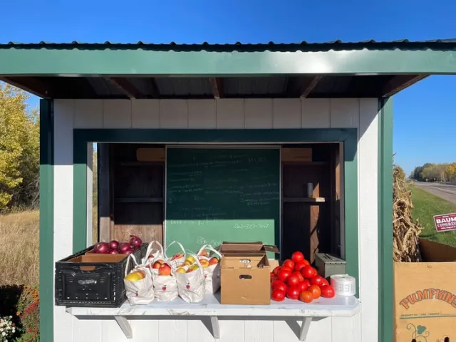
We’re back from the Price County Farmers Market, and the Catawba Farms roadside stand is freshly restocked!We’ve got fresh tomatoes, onions, jalapeños, garlic, Honeycrisp apples, squash, and more ready for you! We’re open 7 days a week, sunup to sundown!Can’t make it during the w...



Timbers Roadhouse weekend hours:Friday, October 9th, open at 3:00, serving fish fry and most menu items at 4:00.Saturday, October 10th, closed for a private party. Sunday, October 11th, open at 11:30 till 4:30 for the Packer game. Kitchen will be closed but snacks will be provide...

Captain Jerry says stop out for Friday Fish Fry at Flyway Resort Bar & Grill. Open and serving at 3pm . Lightly hand breaded Lake Perch, Lightly Breaded Walleye, Baked Cod (Poormans), or Breaded shrimp. All served with baked potato or French Fries, coleslaw and delicious garlic t...